Difference between revisions of "Manjakandriana"
From MadaCamp
CampMaster (talk | contribs) m (Text replacement - "<googlemap version="0.9" (.*)>" to "<googlemap version="0.9" $1 style="width:100%;max-width:600px;">") |
|||
| Line 10: | Line 10: | ||
|} | |} | ||
| − | < | + | <div style="max-width:600px;"> |
| − | -18.921127, 47.811175 | + | {{#display_map: |
| − | + | -18.921127, 47.811175~'''Manjakandriana'''~~; | |
| − | </ | + | |type=satellite |
| + | |service=google | ||
| + | |width=auto | ||
| + | |height=400 | ||
| + | |zoom=16 | ||
| + | |controls=pan, zoom, type, scale | ||
| + | |copycoords=yes | ||
| + | |icon=https://www.madacamp.com/images/madagascar/Green_marker.png | ||
| + | }} | ||
| + | </div> | ||
| + | |||
| + | == Additional information == | ||
| + | |||
| + | View all [[Manjakandriana photos]] | ||
Latest revision as of 07:30, 7 January 2021
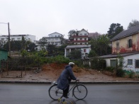
The town of Manjakandriana is located in the highlands of Madagascar along the RN2, about 49 kilometres east of Antananarivo.
| 600px | ||
| 196px | 
|

|
Loading map...
Additional information
View all Manjakandriana photos