Difference between revisions of "S15°28.454' E050°25.923'"
From MadaCamp
CampMaster (talk | contribs) |
|||
| (One intermediate revision by the same user not shown) | |||
| Line 1: | Line 1: | ||
| + | road splitting at S15°28.454' E050°25.923' leading to Ratsianarana | ||
| + | |||
[[File:20161218_142650_DSC00037.jpg|600px]] | [[File:20161218_142650_DSC00037.jpg|600px]] | ||
| − | < | + | <div style="max-width:600px;"> |
| − | -15.474233, 50.432050 | + | {{#display_map: |
| − | road splits at [[S15°28.454' E050°25.923']] leading to [[Ratsianarana]] | + | -15.474233, 50.432050~'''road splits at [[S15°28.454' E050°25.923']] leading to [[Ratsianarana]]'''~~; |
| − | </ | + | |type=satellite |
| + | |service=google | ||
| + | |width=auto | ||
| + | |height=400 | ||
| + | |zoom=14 | ||
| + | |controls=pan, zoom, type, scale | ||
| + | |copycoords=yes | ||
| + | |icon=https://www.madacamp.com/images/madagascar/Green_marker.png | ||
| + | }} | ||
| + | </div> | ||
| + | |||
| + | == Additional information == | ||
| + | |||
| + | * 7 days trek from [[Maroantsetra Antalaha trek around the Masoala peninsula|Maroantsetra to Antalaha around the Masoala peninsula]] | ||
Latest revision as of 10:01, 3 January 2021
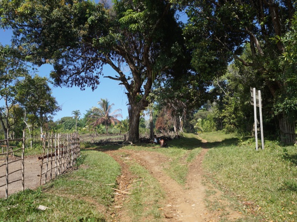
road splitting at S15°28.454' E050°25.923' leading to Ratsianarana
Loading map...
Additional information
- 7 days trek from Maroantsetra to Antalaha around the Masoala peninsula
