Difference between revisions of "Fampotakely"
From MadaCamp
| Line 1: | Line 1: | ||
| + | {| class="imageTable" | ||
| + | |- | ||
| + | |colspan="3" | [[File:Fampotakely_034.jpg|600px]] | ||
| + | |- | ||
| + | |[[File:Fampotakely_042.jpg|196px]] | ||
| + | |align="center"|[[File:Fampotakely_027.jpg|196px]] | ||
| + | |align="right"|[[File:Fampotakely_038.jpg|196px]] | ||
| + | |- | ||
| + | |colspan="3" | [[File:Fampotakely_064.jpg|600px]] | ||
| + | |- | ||
| + | |[[File:Fampotakely_097.jpg|196px]] | ||
| + | |align="center"|[[File:Fampotakely_061.jpg|196px]] | ||
| + | |align="right"|[[File:Fampotakely_100.jpg|196px]] | ||
| + | |} | ||
| + | |||
<div style="max-width:600px;"> | <div style="max-width:600px;"> | ||
{{#display_map: | {{#display_map: | ||
| Line 6: | Line 21: | ||
|width=auto | |width=auto | ||
|height=400 | |height=400 | ||
| − | |zoom= | + | |zoom=13 |
|controls=pan, zoom, type, scale | |controls=pan, zoom, type, scale | ||
|copycoords=yes | |copycoords=yes | ||
| Line 13: | Line 28: | ||
</div> | </div> | ||
| − | The next village south of | + | The next village south of Fampotakely is [[Ampanavoana]] and the next village direction north is [[Libertalia village]]. |
'''GPS coordinates'''<br> | '''GPS coordinates'''<br> | ||
Latest revision as of 08:52, 3 January 2021
| ||

|
|
|
| ||

|
|
|
Loading map...
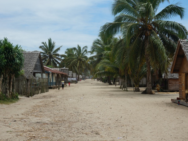
The next village south of Fampotakely is Ampanavoana and the next village direction north is Libertalia village.
GPS coordinates
S 15°35.673'
E050°24.093'
12m elevation
Photos
View all Fampotakely photos
Additional information
- 7 days trek from Maroantsetra to Antalaha around the Masoala peninsula - Fampotakely lies on the path sneaking around the Masoala Peninsula.
- Rosewood Trade: An Illicit Trail from Forest to Furniture - An e360 investigation follows the trail of destruction and corruption from the forests of Madagascar to furniture showrooms in China. (29th January 2019)