Difference between revisions of "Antsambalahy"
From MadaCamp
| Line 1: | Line 1: | ||
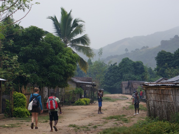
'''The village of Antsambalahy is located next to a river along the old "smuggler's path", connecting [[Maroantsetra]] with [[Antalaha]] across the [[Masoala|Masoala Peninsula]] in the north east of Madagascar.''' | '''The village of Antsambalahy is located next to a river along the old "smuggler's path", connecting [[Maroantsetra]] with [[Antalaha]] across the [[Masoala|Masoala Peninsula]] in the north east of Madagascar.''' | ||
| + | |||
| + | {| class="imageTable" | ||
| + | |- | ||
| + | |colspan="3" | [[File:Antsambalahy_001.jpg|600px]] | ||
| + | |- | ||
| + | |[[File:Antsambalahy_002.jpg|196px]] | ||
| + | |align="center"|[[File:Antsambalahy_003.jpg|196px]] | ||
| + | |align="right"|[[File:Antsambalahy_004.jpg|196px]] | ||
| + | |- | ||
| + | |[[File:Antsambalahy_005.jpg|196px]] | ||
| + | |align="center"|[[File:Antsambalahy_006.jpg|196px]] | ||
| + | |align="right"|[[File:Antsambalahy_007.jpg|196px]] | ||
| + | |} | ||
<googlemap version="0.9" lat="-15.111797" lon="50.102001" zoom="17" controls="large"> | <googlemap version="0.9" lat="-15.111797" lon="50.102001" zoom="17" controls="large"> | ||
| Line 10: | Line 23: | ||
E050°05.997'<br> | E050°05.997'<br> | ||
68m elevation | 68m elevation | ||
| + | |||
| + | View all [[Antsambalahy photos]] | ||
Revision as of 13:47, 1 March 2015
The village of Antsambalahy is located next to a river along the old "smuggler's path", connecting Maroantsetra with Antalaha across the Masoala Peninsula in the north east of Madagascar.

| ||

|

|

|

|

|

|
GPS Coordinates
S 15°06.738'
E050°05.997'
68m elevation
View all Antsambalahy photos