Difference between revisions of "Rantabe"
From MadaCamp
CampMaster (talk | contribs) |
|||
| Line 17: | Line 17: | ||
|} | |} | ||
| − | < | + | <div style="max-width:600px;"> |
| − | -15.61, 49.945804 | + | {{#display_map: |
| − | + | -15.61, 49.945804~[[File:Rantabe 005.jpg|left|150px||]]<br>'''[[Rantabe]]'''~~; | |
| − | </ | + | |type=satellite |
| + | |service=google | ||
| + | |width=auto | ||
| + | |height=400 | ||
| + | |zoom=15 | ||
| + | |controls=pan, zoom, type, scale | ||
| + | |copycoords=yes | ||
| + | |icon=https://www.madacamp.com/images/madagascar/Green_marker.png | ||
| + | }} | ||
| + | </div> | ||
The village south of Rantabe is [[Ambanizana]]. The next village north is [[Nandrahanana]]. | The village south of Rantabe is [[Ambanizana]]. The next village north is [[Nandrahanana]]. | ||
| + | |||
| + | == Additional information == | ||
View all [[Rantabe photos]] | View all [[Rantabe photos]] | ||
Revision as of 07:05, 16 January 2021
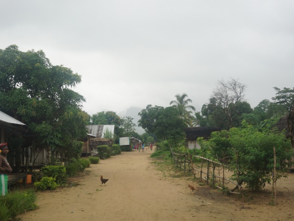
Rantabe is a small village between and within a short distance of two larger villages along the national trail leading around the Masoala peninsula.
| ||

|
|

|

|
|

|
| ||
Loading map...
The village south of Rantabe is Ambanizana. The next village north is Nandrahanana.
Additional information
View all Rantabe photos