|
|
| Line 17: |
Line 17: |
| | -15.592330, 49.924677~[[File:Nandrahanana 035.jpg|left|150px|]]<br>'''Nandrahanana'''~~; | | -15.592330, 49.924677~[[File:Nandrahanana 035.jpg|left|150px|]]<br>'''Nandrahanana'''~~; |
| | |type=satellite | | |type=satellite |
| − | |service=google | + | |service=leaflet |
| | |width=auto | | |width=auto |
| | |height=400 | | |height=400 |
Latest revision as of 20:02, 1 May 2025
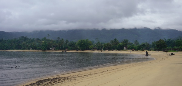
Nandrahanana is a coastal village along the national trail leading around the Masoala peninsula.
Loading map...
{"minzoom":false,"maxzoom":false,"mappingservice":"leaflet","width":"auto","height":"400px","centre":false,"title":"","label":"","icon":"https://www.madacamp.com/images/madagascar/Green_marker.png","visitedicon":"","lines":[],"polygons":[],"circles":[],"rectangles":[],"wmsoverlay":false,"copycoords":true,"static":false,"zoom":14,"defzoom":14,"layer":"OpenStreetMap","overlaylayers":[],"resizable":false,"enablefullscreen":false,"markercluster":false,"clustermaxzoom":20,"clusterzoomonclick":true,"clustermaxradius":80,"clusterspiderfy":true,"locations":[{"text":"\u003Cdiv class=\"floatleft\"\u003E\u003Ca href=\"/File:Nandrahanana_035.jpg\" class=\"image\"\u003E\u003Cimg alt=\"Nandrahanana 035.jpg\" src=\"/images/madagascar/thumb/Nandrahanana_035.jpg/150px-Nandrahanana_035.jpg\" width=\"150\" height=\"113\" srcset=\"/images/madagascar/thumb/Nandrahanana_035.jpg/225px-Nandrahanana_035.jpg 1.5x, /images/madagascar/thumb/Nandrahanana_035.jpg/300px-Nandrahanana_035.jpg 2x\" /\u003E\u003C/a\u003E\u003C/div\u003E\u003Cbr /\u003E\u003Cb\u003ENandrahanana\u003C/b\u003E\n","title":"Nandrahanana\n","link":"","lat":-15.59233,"lon":49.924677,"icon":"https://www.madacamp.com/images/madagascar/Green_marker.png"}],"imageoverlays":null}
The village south of Nandrahanana is Rantabe. The next village north following the fishing hamlets of Ananovato and Ambolosy (15°27'39.9"S 49°53'46.6"E) is Iaraka.
Additional information
View all Nandrahanana photos


