Vohitrarivo farmland
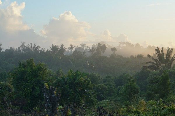
Vohitrarivo farmland is a 40ha land area next to the village of Vohitrarivo in the SAVA region of north east of Madagascar. Located in one of the cleanest parts of the world, the land area has been sparsely used for small-scale farming, always without use of fertilisers, pesticides or fossil-fueled farming methods throughout its history. The land itself and its surrounding terroir is 100% naturally biological.
The land, which is in its third generation of Malagasy ownership, has been used for farming purposes for two generations. With the exception of some small-scale cultivation for personal needs of land caretakers from Vohitrarivo village, regular farming has been inactive since about year 2000, which has left vegetation in most areas grow wild the way nature designs it.
Crops and plants, some wild, include corn, sugarcane, pinapple, mango, lychee, cococut, banana, pepper, bamboo, breadfruit, vanilla, cassava, coffee, papaya, cocoa, chilli, cinammon and more. In organic farming practice, this makes the ideal companion-planting habitat as it require no use of unnatural pesticides as often needed to in single-crop farming operations.
The site is located about 25km from the coast of the Indian Ocean and 20km inland about half-way between Antalaha and Sambava.
From the crossing at Ambodipont Isahana, a village of about 300 inhabitants, take the road inland, passing Tananabaovao after 4.6km, a village of about 100 inhabitants. 7.6km after is the village of Ambinanifaho with about 2,000 inhabitants. 8km further is the village of Ambodilalona with about 800 inhabitants and 3km thereafter is Lanjarivo with about 1,000 inhabits and finally 2km from there is Vohitrarivo with about 500 inhabitants. Vohitrarivo is the nearest village to the land starting at 1km further inland from the village.
The river Farariana runs through the land. There are no inhabited villages further upstream between the land area and the source of the river, making the water water perfectly safe to drink. Downstream, Farariana joins the Tananbao river and leads into the Indian Ocean.
Distance around: 4.3 km
Minimum elevation: 12 m
Maximum elevation: 51 m

