When travelling to Andapa, up and above the road to the left at S 14°37.968' E049°42.404 and at an altitude of 500 metres, a monument built by the Italian contractor that were constructing the road between Andapa and Sambava in mid-1960 can be seen from the road.
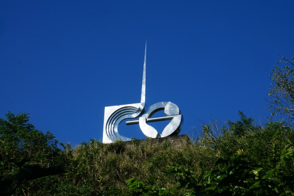
The road took six years to complete including the construction of heavy bridges crossing rivers and valleys. The circular arm-shaped part of the monument signifies the strength of the men carrying equipment and materials and the upwards pointing needle represents the way ahead.
The location served as a coffee stop for construction workers after having reached the road's peak coming from Andapa.
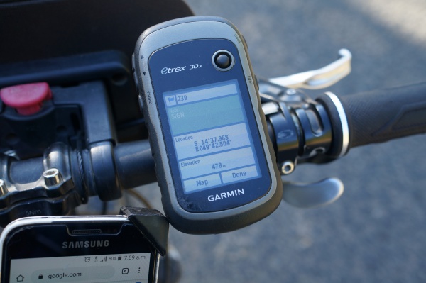
The monument is located Between Masiaposa and Andrakata.
Loading map...
{"minzoom":false,"maxzoom":false,"mappingservice":"googlemaps3","type":"SATELLITE","types":["ROADMAP","SATELLITE","HYBRID","TERRAIN"],"width":"auto","height":"400px","centre":{"text":"","title":"","link":"","lat":-14.633217049969,"lon":49.708257842922,"icon":""},"title":"","label":"","icon":"","visitedicon":"","lines":[],"polygons":[],"circles":[],"rectangles":[],"wmsoverlay":false,"copycoords":true,"static":false,"zoom":15,"layers":[],"controls":["pan","zoom","type","scale"],"zoomstyle":"DEFAULT","typestyle":"DEFAULT","autoinfowindows":false,"resizable":false,"kmlrezoom":false,"poi":true,"markercluster":false,"clustergridsize":60,"clustermaxzoom":20,"clusterzoomonclick":true,"clusteraveragecenter":true,"clusterminsize":2,"tilt":0,"imageoverlays":[],"kml":[],"gkml":[],"fusiontables":[],"searchmarkers":"","enablefullscreen":false,"locations":[{"text":"\u003Cp\u003E\u003Cb\u003EMonument\u003C/b\u003E\n\u003C/p\u003E","title":"Monument\n","link":"","lat":-14.633217049969,"lon":49.708257842922,"icon":""}]}
Related information

