Difference between revisions of "Ambodimanga Ramena"
From MadaCamp
CampMaster (talk | contribs) |
|||
| Line 1: | Line 1: | ||
'''Ambodimanga Ramena is a village and commune in the district of [[Ambanja]] in the northwest of Madagascar. As the name indicates, Ambodimanga Ramena is located along the Ramena River.''' | '''Ambodimanga Ramena is a village and commune in the district of [[Ambanja]] in the northwest of Madagascar. As the name indicates, Ambodimanga Ramena is located along the Ramena River.''' | ||
| − | <googlemap version="0.9" lat="-13.762373" lon="48.493863" type="satellite" zoom="16" controls="large"> | + | {| class="imageTable" |
| + | |- | ||
| + | |colspan="3" | [[File:Ambodimanga_Ramena_003.jpg|600px]] | ||
| + | |- | ||
| + | |[[File:Ambodimanga_Ramena_004.jpg|196px]] | ||
| + | |align="center"|[[File:Ambodimanga_Ramena_016.jpg|196px]] | ||
| + | |align="right"|[[File:Ambodimanga_Ramena_005.jpg|196px]] | ||
| + | |- | ||
| + | |} | ||
| + | |||
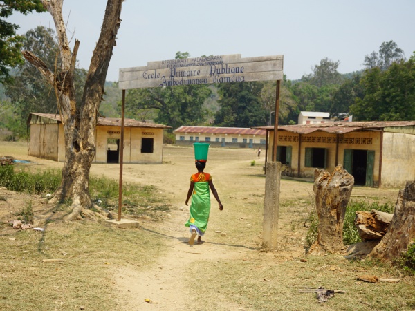
| + | At the village border there is a public primary school. | ||
| + | |||
| + | [[File:Ambodimanga_Ramena_011.jpg|600px]] | ||
| + | |||
| + | <googlemap version="0.9" lat="-13.762373" lon="48.493863" type="satellite" zoom="16" controls="large" style="width:100%;max-width:600px;"> | ||
-13.763217, 48.492984 | -13.763217, 48.492984 | ||
Ambodimanga Ramena | Ambodimanga Ramena | ||
| Line 10: | Line 24: | ||
Garmin: -13.762863, 48.494389 | Garmin: -13.762863, 48.494389 | ||
| − | View all [[Ambodimanga Ramena photos]] | + | |
| + | '''Additional information''' | ||
| + | * View all [[Ambodimanga Ramena photos]] | ||
| + | * [[Sambirano Trekking Tour]] | ||
Revision as of 05:05, 25 July 2017
Ambodimanga Ramena is a village and commune in the district of Ambanja in the northwest of Madagascar. As the name indicates, Ambodimanga Ramena is located along the Ramena River.
| ||
|
|
|
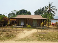
At the village border there is a public primary school.
GPS coordinates
Google: 13°45'46.3"S 48°29'39.8"E
Garmin: -13.762863, 48.494389
Additional information
