|
|
| (14 intermediate revisions by 2 users not shown) |
| Line 1: |
Line 1: |
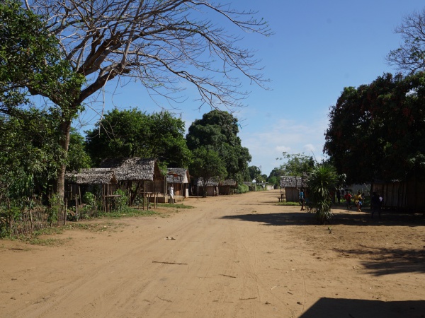
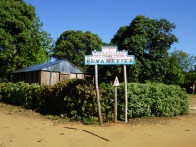
| − | '''Bemanevika is a village along the vanilla route close to [[Sambava]]'''. | + | '''Bemanevika is a village at the end of [[Bemarivo]] between 15km and 30km from [[Sambava]] depending on the route.''' |
| | | | |
| | {| class="imageTable" | | {| class="imageTable" |
| Line 14: |
Line 14: |
| | |} | | |} |
| | | | |
| − | [[File:Bemanevika 001.jpg|600px]]
| + | <div style="max-width:600px;"> |
| − | [[File:Bemanevika 002.jpg|600px]]
| + | {{#display_map: |
| − | [[File:Bemanevika 003.jpg|600px]]
| + | -14.140906, 50.125655~'''Bemanevika'''~~; |
| − | [[File:Bemanevika 004.jpg|600px]]
| + | |type=satellite |
| − | [[File:Bemanevika 005.jpg|600px]]
| + | |service=google |
| − | [[File:Bemanevika 006.jpg|600px]]
| + | |width=auto |
| − | [[File:Bemanevika 007.jpg|600px]]
| + | |height=400 |
| − | [[File:Bemanevika 008.jpg|600px]]
| + | |zoom=13 |
| − | [[File:Bemanevika 009.jpg|600px]]
| + | |controls=pan, zoom, type, scale |
| − | [[File:Bemanevika 010.jpg|600px]]
| + | |copycoords=yes |
| − | [[File:Bemanevika 011.jpg|600px]]
| + | }} |
| − | [[File:Bemanevika 012.jpg|600px]]
| + | </div> |
| − | [[File:Bemanevika 013.jpg|600px]]
| |
| − | [[File:Bemanevika 014.jpg|600px]]
| |
| − | [[File:Bemanevika 015.jpg|600px]]
| |
| − | [[File:Bemanevika 016.jpg|600px]]
| |
| − | [[File:Bemanevika 017.jpg|600px]]
| |
| − | [[File:Bemanevika 018.jpg|600px]]
| |
| − | [[File:Bemanevika 019.jpg|600px]]
| |
| − | [[File:Bemanevika 020.jpg|600px]]
| |
| − | [[File:Bemanevika 021.jpg|600px]]
| |
| − | [[File:Bemanevika 022.jpg|600px]]
| |
| − | [[File:Bemanevika 023.jpg|600px]]
| |
| − | [[File:Bemanevika 024.jpg|600px]]
| |
| − | [[File:Bemanevika 025.jpg|600px]]
| |
| − | [[File:Bemanevika 026.jpg|600px]]
| |
| − | [[File:Bemanevika 027.jpg|600px]]
| |
| − | [[File:Bemanevika 028.jpg|600px]]
| |
| − | [[File:Bemanevika 029.jpg|600px]]
| |
| − | [[File:Bemanevika 030.jpg|600px]]
| |
| − | [[File:Bemanevika 031.jpg|600px]]
| |
| − | [[File:Bemanevika 032.jpg|600px]]
| |
| − | [[File:Bemanevika 033.jpg|600px]]
| |
| − | [[File:Bemanevika 034.jpg|600px]]
| |
| − | [[File:Bemanevika 035.jpg|600px]]
| |
| − | [[File:Bemanevika 036.jpg|600px]]
| |
| − | [[File:Bemanevika 037.jpg|600px]]
| |
| − | [[File:Bemanevika 038.jpg|600px]]
| |
| − | [[File:Bemanevika 039.jpg|600px]]
| |
| − | [[File:Bemanevika 040.jpg|600px]]
| |
| − | [[File:Bemanevika 041.jpg|600px]]
| |
| − | [[File:Bemanevika 042.jpg|600px]]
| |
| − | [[File:Bemanevika 043.jpg|600px]]
| |
| − | [[File:Bemanevika 044.jpg|600px]]
| |
| − | [[File:Bemanevika 045.jpg|600px]]
| |
| − | [[File:Bemanevika 046.jpg|600px]]
| |
| − | [[File:Bemanevika 047.jpg|600px]]
| |
| − | [[File:Bemanevika 048.jpg|600px]]
| |
| − | [[File:Bemanevika 049.jpg|600px]]
| |
| − | [[File:Bemanevika 050.jpg|600px]]
| |
| − | [[File:Bemanevika 051.jpg|600px]]
| |
| − | [[File:Bemanevika 052.jpg|600px]]
| |
| − | [[File:Bemanevika 053.jpg|600px]]
| |
| − | [[File:Bemanevika 054.jpg|600px]]
| |
| − | [[File:Bemanevika 055.jpg|600px]]
| |
| − | [[File:Bemanevika 056.jpg|600px]]
| |
| − | [[File:Bemanevika 057.jpg|600px]]
| |
| | | | |
| | + | There are two routes to Bemanevika, one via Nosarina and another shorter distance across the creek onto the half-island from of Sambava-Centre via the Soavanio plantation until a second river crossing shortly after Antongomphitra. |
| | | | |
| − | <googlemap version="0.9" lat="-14.140864" lon="50.125548" zoom="14">
| + | == Photos == |
| − | -14.140906, 50.125655
| |
| − | Bemanevika
| |
| − | </googlemap>
| |
| | | | |
| | View all [[Bemanevika photos]] | | View all [[Bemanevika photos]] |
| | + | |
| | + | == Additional information == |
| | + | |
| | + | * [[Bemanevika_to_Sambava_by_bike|Bike ride Bemanevika to Sambava]] - 14.2 km |
| | + | * [[Sambava_to_Bemanevika_by_bike|Bike ride Sambava to Bemanevika]] - 30.7 km |
| | + | * [[Sambava-Bemanevika-Sambava_by_bike|Bike ride Sambava to Bemanevika to Sambava]] - 47.8 km |
| | + | * [[Sambava_to_Farihy_Ampasimbato_by_bike|Bike ride Sambava to Farihy Ampasimbato]] - 49 km return |
Loading map...
{"minzoom":false,"maxzoom":false,"mappingservice":"googlemaps3","type":"SATELLITE","types":["ROADMAP","SATELLITE","HYBRID","TERRAIN"],"width":"auto","height":"400px","centre":false,"title":"","label":"","icon":"","visitedicon":"","lines":[],"polygons":[],"circles":[],"rectangles":[],"wmsoverlay":false,"copycoords":true,"static":false,"zoom":13,"layers":[],"controls":["pan","zoom","type","scale"],"zoomstyle":"DEFAULT","typestyle":"DEFAULT","autoinfowindows":false,"resizable":false,"kmlrezoom":false,"poi":true,"markercluster":false,"clustergridsize":60,"clustermaxzoom":20,"clusterzoomonclick":true,"clusteraveragecenter":true,"clusterminsize":2,"tilt":0,"imageoverlays":[],"kml":[],"gkml":[],"fusiontables":[],"searchmarkers":"","enablefullscreen":false,"locations":[{"text":"\u003Cp\u003E\u003Cb\u003EBemanevika\u003C/b\u003E\n\u003C/p\u003E","title":"Bemanevika\n","link":"","lat":-14.140906,"lon":50.125655,"icon":""}]}
There are two routes to Bemanevika, one via Nosarina and another shorter distance across the creek onto the half-island from of Sambava-Centre via the Soavanio plantation until a second river crossing shortly after Antongomphitra.
