Difference between revisions of "Antanambao (Masoala)"
From MadaCamp
CampMaster (talk | contribs) (Created page with "'''Antanambao is a common village name in Madagascar. The Antanambao pictured on this page is located on the coast at the southern part of the Masoala Peninsula, in the northe...") |
|||
| (One intermediate revision by one other user not shown) | |||
| Line 29: | Line 29: | ||
|} | |} | ||
| − | < | + | <div style="max-width:600px;"> |
| − | -15.935265, 50.239165 | + | {{#display_map: |
| − | Antanambo (Masoala) | + | -15.935265, 50.239165~'''Antanambo''' (Masoala)~~; |
| − | </ | + | |type=satellite |
| + | |service=google | ||
| + | |width=auto | ||
| + | |height=400 | ||
| + | |zoom=15 | ||
| + | |controls=pan, zoom, type, scale | ||
| + | |copycoords=yes | ||
| + | |icon=https://www.madacamp.com/images/madagascar/Green_marker.png | ||
| + | }} | ||
| + | </div> | ||
| + | |||
| + | The next village direction southwest is [[Beankora]]. The next village direction north is [[Vinanivao]]. | ||
'''GPS coordinates'''<br> | '''GPS coordinates'''<br> | ||
| Line 39: | Line 50: | ||
12m elevation | 12m elevation | ||
| + | == Photos == | ||
| + | |||
| + | View all [[Antanambao_(Masoala)_photos|Antanambao photos]] | ||
| + | |||
| + | == Additional information == | ||
| − | + | * 7 days trek from [[Maroantsetra Antalaha trek around the Masoala peninsula|Maroantsetra to Antalaha around the Masoala peninsula]] - The village of Antanambao lies on the path sneaking around the Masoala Peninsula. | |
| − | * | ||
| − | |||
Latest revision as of 15:10, 31 December 2020
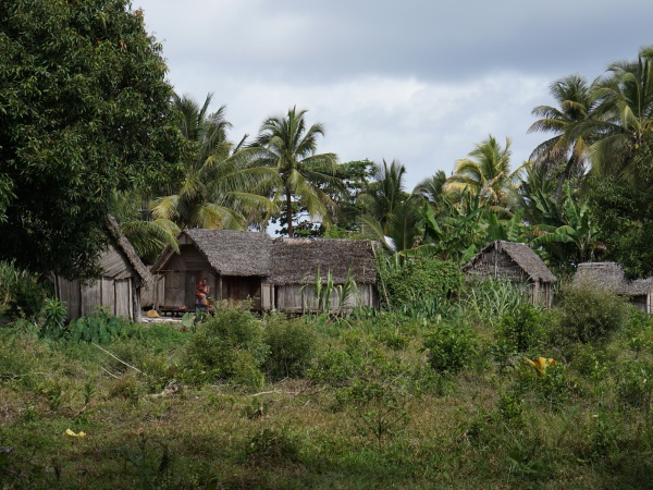
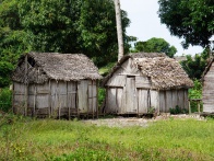
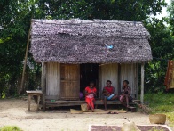
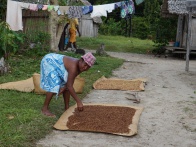
Antanambao is a common village name in Madagascar. The Antanambao pictured on this page is located on the coast at the southern part of the Masoala Peninsula, in the northeast of Madagascar.
| ||
|

|
|
|

|

|

| ||

|

|

|

|

|

|
Loading map...
The next village direction southwest is Beankora. The next village direction north is Vinanivao.
GPS coordinates
S 15°56.132'
E050°14.348'
12m elevation
Photos
View all Antanambao photos
Additional information
- 7 days trek from Maroantsetra to Antalaha around the Masoala peninsula - The village of Antanambao lies on the path sneaking around the Masoala Peninsula.