Difference between revisions of "Maroantsetra Antalaha trek"
CampMaster (talk | contribs) (→Day 2) |
|||
| (36 intermediate revisions by 2 users not shown) | |||
| Line 10: | Line 10: | ||
|} | |} | ||
| − | < | + | <div style="max-width:600px;"> |
| − | -15.434295, 49.740354 | + | {{#display_map: |
| − | [[Maroantsetra]] | + | -15.434295, 49.740354~[[File:Maroantsetra_012.jpg|left|150px|]]<br>'''[[Maroantsetra]]'''~~; |
| − | -15.426875, 49.804544 | + | -15.426875, 49.804544~'''[[Andranofotsy]]'''~~; |
| − | [[Andranofotsy]] | + | -15.42405, 49.838707~'''[[Farankaraina Tropical Park]]'''~~; |
| − | -15.42405, 49.838707 | + | -15.410833, 49.867783~[[File:Navana_019.jpg|left|150px|]]<br>'''[[Navana]]'''~~; |
| − | [[Farankaraina Tropical Park]] | + | -15.409033, 49.88895~'''[[Anjahana]]'''~~; |
| − | -15.410833, 49.867783 | + | -15.4139, 49.9153~[[File:Mahalevona_013.jpg|left|150px|]]<br>'''[[Mahalevona]]'''~~; |
| − | [[Navana]] | + | -15.375667, 49.93865~[[File:Tanambao_008.jpg|left|150px|]]<br>'''[[Tanambao]]'''~~; |
| − | -15.409033, 49.88895 | + | -15.343583, 49.94805~[[File:Fizono_04.jpg|left|150px|]]<br>'''[[Fizono]] (or Fizoana)'''~~; |
| − | [[Anjahana]] | + | -15.307317, 49.986597~[[File:Ankovana_011.jpg|left|150px|]]<br>'''[[Ankovana]]'''~~; |
| − | -15.4139, 49.9153 | + | -15.288467, 50.011685~[[File:Ambatolaidama_007.jpg|left|150px|]]<br>'''[[Ambatolaidama]]'''~~; |
| − | [[Mahalevona]] | + | -15.272806, 50.032585~[[File:Ambohimarina_013.jpg|left|150px|]]<br>'''[[Ambohimarina_(Masoala)|Ambohimarina]]'''~~; |
| − | -15.375667, 49.93865 | + | -15.2562, 50.059183~[[File:Ampokafo_019.jpg|left|150px|]]<br>'''[[Ampokafo]]'''~~; |
| − | [[Tanambao]] | + | -15.239385, 50.069371~[[File:Manakambahiny_005.jpg|left|150px|]]<br>'''[[Manakambahiny]]'''~~; |
| − | -15.343583, 49.94805 | + | -15.215505, 50.074861~[[File:Andrakadilana_011.jpg|left|150px|]]<br>'''[[Andrakadilana]]'''~~; |
| − | [[Fizono]] ( | + | -15.197419, 50.080694~[[File:Androfary_002.jpg|left|150px|]]<br>'''[[Androfary]]'''~~; |
| − | -15.307317, 49.986597 | + | -15.163605, 50.087526~[[File:Antakotako_007.jpg|left|150px|]]<br>'''[[Antakotako]]'''~~; |
| − | [[Ankovana]] | + | -15.130717, 50.092833~[[File:Ambalaharongana_038.jpg|left|150px|]]<br>'''[[Ambalaharongana]]'''~~; |
| − | -15.288467, 50.011685 | + | -15.112321, 50.100358~'''[[Antsambalahy]]'''~~; |
| − | [[Ambatolaidama]] | + | -15.100317, 50.103546~'''[[Analampotsy]]'''~~; |
| − | -15.272806, 50.032585 | + | -15.10004, 50.103554~'''[[Antsahabe]]'''~~; |
| − | [[Ambohimarina]] | + | -15.066435, 50.116402~'''[[Antsefapiana]]'''~~; |
| − | -15.2562, 50.059183 | + | -15.054683, 50.1191~'''[[Tsarafanahy]]'''~~; |
| − | [[Ampokafo]] | + | -15.039083, 50.1161~'''[[Marofinaritra]]'''~~; |
| − | -15.239385, 50.069371 | + | -14.999817, 50.13755~'''[[Maromandia]]'''~~; |
| − | [[Manakambahiny]] | + | -14.993659, 50.167896~'''[[Antombana]]'''~~; |
| − | -15.215505, 50.074861 | + | -14.987533, 50.190617~'''[[Antsahandriana]]'''~~; |
| − | [[Andrakadilana]] | + | -14.9879, 50.212783~'''[[Antserasera]]'''~~; |
| − | -15.197419, 50.080694 | + | -14.973786, 50.219874~'''[[Mahatsara]]'''~~; |
| − | [[Androfary]] | + | -14.954017, 50.2312~'''[[Fiangonana]]'''~~; |
| − | -15.163605, 50.087526 | + | -14.910699, 50.282364~[[File:Antalaha_11.jpg|left|150px|]]<br>'''[[Antalaha]]'''~~; |
| − | [[Antakotako]] | + | |type=satellite |
| − | -15.130717, 50.092833 | + | |service=google |
| − | [[Ambalaharongana]] | + | |width=auto |
| − | -15.112321, 50.100358 | + | |height=750 |
| − | [[Antsambalahy]] | + | |zoom=10 |
| − | -15.100317, 50.103546 | + | |controls=pan, zoom, type, scale |
| − | [[Analampotsy]] | + | |copycoords=yes |
| − | -15.10004, 50.103554 | + | |icon=https://www.madacamp.com/images/madagascar/Green_marker.png |
| − | [[Antsahabe]] | + | }} |
| − | -15.066435, 50.116402 | + | </div> |
| − | [[Antsefapiana]] | + | |
| − | -15.054683, 50.1191 | + | [[File:Trek_Maroantsetra_Antalaha_011.jpg|600px]] |
| − | [[Tsarafanahy]] | ||
| − | -15.039083, 50.1161 | ||
| − | [[Marofinaritra]] | ||
| − | -14.999817, 50.13755 | ||
| − | [[Maromandia]] | ||
| − | -14.993659, 50.167896 | ||
| − | [[Antombana]] | ||
| − | -14.987533, 50.190617 | ||
| − | [[Antsahandriana]] | ||
| − | -14.9879, 50.212783 | ||
| − | [[Antserasera]] | ||
| − | -14.973786, 50.219874 | ||
| − | [[Mahatsara]] | ||
| − | -14.954017, 50.2312 | ||
| − | [[Fiangonana]] | ||
| − | -14.910699, 50.282364 | ||
| − | [[Antalaha]] | ||
| − | </ | ||
The about 152km trail sneaks along rivers, through many small villages and cultivated areas, with a short distance through the [[Masoala National Park]]. | The about 152km trail sneaks along rivers, through many small villages and cultivated areas, with a short distance through the [[Masoala National Park]]. | ||
| Line 79: | Line 61: | ||
=== Day 1 === | === Day 1 === | ||
'''[[Maroantsetra]] - [[Andranofotsy]] - [[Farankaraina Tropical Park]] - [[Navana]] - [[Anjahana]] - [[Mahalevona]]'''<br> | '''[[Maroantsetra]] - [[Andranofotsy]] - [[Farankaraina Tropical Park]] - [[Navana]] - [[Anjahana]] - [[Mahalevona]]'''<br> | ||
| − | After a night at Hotel Le Coco Beach in Maroantsetra we walked in the early morning hours through the small town to the river where the pirogues to Andranofotsy leave from. Along the way to the "harbour" we stopped at the market to have some breakfast. For our relatively large pirogue we paid 12,000 Ariary for three people and left around 8.20am. There were also cheaper pirogues available, but we would | + | After a night at Hotel Le Coco Beach in Maroantsetra we walked in the early morning hours a bit less than 4km <!-- 4392 steps --> through the small town to the river where the pirogues to Andranofotsy leave from. Along the way to the "harbour" we stopped at the market to have some breakfast. For our relatively large pirogue we paid 12,000 Ariary for three people and left around 8.20am. There were also cheaper pirogues available, but we would have to wait until one is filled with passengers. |
| − | [[File:Mahalevona 013.jpg|600px]] | + | [[File:Mahalevona 013.jpg|600px|link=Mahalevona]] |
| − | For the next 1 | + | For the next 1 hour and 20 minutes, it was a very pleasant, relaxing pirogue ride with amazing scenery along the many small river arms of <i>[[Andranofotsy River]]</i>. Around 9.40pm we arrived near Andranofotsy. |
| − | + | <HTML5video type="youtube">uRc7S9Cl11Y</HTML5video> | |
| − | Around noon we arrived in Navana and had some lunch in one of the small restaurants. 4km later we arrived in Mahavelona, passing Anjahana along the way. Before entering Mahavelona there is a beautiful | + | Now the actual walk started, following the coastline with views of [[Nosy Mangabe]] in [[Antongil Bay]]. Once we reached inland we passed [[Farankaraina Tropical Park]], which we visited for a short trek through the rainforest. For those who are not in a rush, we recommend to spend more time in this park and stay over in one of their bungalows. |
| − | valley with rice fields and a mountainous background | + | |
| + | Around noon we arrived in Navana and had some lunch in one of the small restaurants. 4km later we arrived in Mahavelona, passing Anjahana along the way. Before entering Mahavelona there is a beautiful valley with rice fields and a mountainous background. In Mahavelona we stayed at [[Hotel Malala]]. After we checked in we went for a swim in the river. In the evening we had a delicious dinner in the restaurant of our hotel. | ||
=== Day 2 === | === Day 2 === | ||
'''[[Mahalevona]] - [[Tanambao]] - [[Fizono]] - [[Ankovana]]'''<br> | '''[[Mahalevona]] - [[Tanambao]] - [[Fizono]] - [[Ankovana]]'''<br> | ||
| − | After breakfast with tea and fried bananas at our hotel we left the village around 6am. As the day before the trail followed the river downstream, sneaking up and down small | + | After breakfast with tea and fried bananas at our hotel, we left the village around 6am. As the day before the trail followed the river downstream, sneaking up and down small hills and through valleys with rice fields. Today was the first time we had to cross the river by foot, which turned out to be no problem with a bit of balancing. |
| − | [[File:Tanambao 007.jpg|600px]] | + | [[File:Tanambao 007.jpg|600px|link=Tanambao]] |
| − | After 1 hour we reached Tanambao, another 1 hour and 20 minutes | + | After 1 hour we reached Tanambao, another 1 hour and 20 minutes Fizono and from there about 1 hour and 45 minutes later our final destination Ankovana at noon. Ankovana is a very small village with very basic accommodation. After a chat with the woman renting out rooms at [[Hotel Centrale Ankovana]] she invited us to stay at her private house next door for 5,000 Ariary per person. We accepted her invitation and were rewarded with a huge dinner (rice, fried egg, boiled vegetables and cucumber salad). Happy and with a full stomachs we fell asleep. |
=== Day 3 === | === Day 3 === | ||
| − | '''[[Ankovana]] - [[Ambatolaidama]] - [[Ambohimarina]] - [[Ampokafo]]'''<br> | + | '''[[Ankovana]] - [[Ambatolaidama]] - [[Ambohimarina_(Masoala)|Ambohimarina]] - [[Ampokafo]]'''<br> |
| − | To avoid the heat of the day we started our walk as usual around 6am. The scenery is similar to the one the day before. However, the highlight is the short walk through [[Park Ambatolaidama]]. At the park entrance the trail starts at an elevation of 375m and goes up to 542m at the exit. The maximum 90 minutes walk through the Masoala forest is steep, humid and very slippery on wet days. The forest is filled with the sound of numerous birds. | + | To avoid the heat of the day we started our walk as usual around 6am. The scenery is similar to the one the day before. However, the highlight is the short walk through [[Park Ambatolaidama]]. At the park entrance, the trail starts at an elevation of 375m and goes up to 542m at the exit. The maximum 90 minutes walk through the Masoala forest is steep, humid and very slippery on wet days. The forest is filled with the sound of numerous birds. |
{| class="imageTable" | {| class="imageTable" | ||
|- | |- | ||
| − | |colspan="3" | [[File:Ampokafo 031.jpg|600px]] | + | |colspan="3" | [[File:Ampokafo 031.jpg|600px|link=Ampokafo]] |
|- | |- | ||
| − | |[[File:Ankovana 036.jpg|196px]] | + | |[[File:Ankovana 036.jpg|196px|link=Ankovana]] |
| − | |align="center"|[[File:Ankovana 033.jpg|196px]] | + | |align="center"|[[File:Ankovana 033.jpg|196px|link=Ankovana]] |
| − | |align="right"|[[File:Ankovana 032.jpg|196px]] | + | |align="right"|[[File:Ankovana 032.jpg|196px|link=Ankovana]] |
|- | |- | ||
| − | |[[File:Ankovana 026.jpg|196px]] | + | |[[File:Ankovana 026.jpg|196px|link=Ankovana]] |
| − | |align="center"|[[File:Ankovana 029.jpg|196px]] | + | |align="center"|[[File:Ankovana 029.jpg|link=Ankovana|196px]] |
| − | |align="right"|[[File:Ankovana 034.jpg|196px]] | + | |align="right"|[[File:Ankovana 034.jpg|196px|link=Ankovana]] |
|- | |- | ||
|} | |} | ||
| − | After leaving the park we reached at 11.45am | + | After leaving the park we reached Ampokafo at 11.45am, where we found a bed for the night at [[Hotel Esperante]]. A short stroll from the village we enjoyed a refreshing bath in the river. Thereafter we discovered the village and found a shop with a cinema behind. The owner agreed to recharge our camera batteries whilst showing a film in the evening. We just had to pay for the diesel. |
=== Day 4 === | === Day 4 === | ||
'''[[Ampokafo]] - [[Manakambahiny]] - Tsaratanana - [[Andrakadilana]] - [[Androfary]] - [[Antakotako]] - [[Ambalaharongana]]'''<br> | '''[[Ampokafo]] - [[Manakambahiny]] - Tsaratanana - [[Andrakadilana]] - [[Androfary]] - [[Antakotako]] - [[Ambalaharongana]]'''<br> | ||
| − | Heavy rain in the night and early morning hours delayed our departure a bit. We soon realised that the trail had turned into a mud pool, making it quite difficult to walk. Sliding backwards down a hill with the hands stretched out in the hope to hold on something, whilst trying not to completely | + | Heavy rain in the night and early morning hours delayed our departure a bit. We soon realised that the trail had turned into a mud pool, making it quite difficult to walk. Sliding backwards down a hill with the hands stretched out in the hope to hold on something, whilst trying not to completely lose the balance or searching for a shoe which got stuck in the mud were only some of the challenges we had to solve. But after even our guide once ended up on his buttocks we did not feel too much like clumsy [[vazaha]] anymore. |
| + | |||
| + | [[File:Manakambahiny 005.jpg|600px|link=Manakambahiny]] | ||
| + | |||
| + | At around 1.30pm we arrived in Ambalaharongana where we went straight to the river to clean us and our clothes from the mud of the day. Besides a school and football field there is not much to see in the village, so we went early to bed in [[Hotel Fitsaharana]]. | ||
=== Day 5 === | === Day 5 === | ||
'''[[Ambalaharongana]] - [[Antsambalahy]] - [[Analampotsy]] - [[Antsahabe]] - [[Antsefapiana]] - [[Tsarafanahy]] - [[Marofinaritra]] - [[Maromandia]] - [[Antombana]] - [[Antsahandriana]] - [[Antserasera]] - [[Mahatsara]] - [[Fiangonana]] - .... - [[Antalaha]]'''<br> | '''[[Ambalaharongana]] - [[Antsambalahy]] - [[Analampotsy]] - [[Antsahabe]] - [[Antsefapiana]] - [[Tsarafanahy]] - [[Marofinaritra]] - [[Maromandia]] - [[Antombana]] - [[Antsahandriana]] - [[Antserasera]] - [[Mahatsara]] - [[Fiangonana]] - .... - [[Antalaha]]'''<br> | ||
| − | The most challenging day - not in elevation but distance, as we walked over 50km to make it to Antalaha before night. After leaving Ambalaharongana at 6am we reached Marofinaritra at almost 10am. The trail ends at Marofinaritra and the road to Antalaha starts. But "road" does not necessarily mean cars. There is the occasional taxi | + | The most challenging day - not in elevation but distance, as we walked over 50km to make it to Antalaha before night. After leaving Ambalaharongana at 6am we reached Marofinaritra at almost 10am. The trail ends at Marofinaritra and the road to Antalaha starts. But "road" does not necessarily mean cars. There is the occasional 4x4 taxi or more likely taxi motorbike on the road. The scenery changes slowly from rice fields to more and more villages and fruit plantations. |
| + | |||
| + | [[File:Ambalaharongana 038.jpg|600px|link=Ambalaharongana]] | ||
| − | ''And without doubt - we will do the walk again!'' | + | As it was Sunday, we walked the last few kilometres together with hundreds of kids who left their villages for a week of school in Antalaha. As the distances are too long to walk back and forth each day, the kids stay throughout the week in the town. After 63,086 steps we finally reached Antalaha just after sunset, exhausted but happy and very proud! It was a great feeling to have been able to answer with "YES" when being asked at the borders of the city if we came from Maroantsetra and to see the admiration in the eyes of askers! |
| + | |||
| + | ''And without a doubt - we will do the walk again!'' | ||
| + | |||
| + | [[File:Antalaha 11.jpg|600px|link=Antalaha]] | ||
== Villages along the trek == | == Villages along the trek == | ||
| Line 150: | Line 143: | ||
[[Ambatolaidama]] (Entrance to [[Masoala National Park]]) | [[Ambatolaidama]] (Entrance to [[Masoala National Park]]) | ||
| − | [[Ambohimarina]] | + | [[Ambohimarina_(Masoala)|Ambohimarina]] |
[[Ampokafo]] (3rd night at [[Hotel Esperante]]) | [[Ampokafo]] (3rd night at [[Hotel Esperante]]) | ||
| Line 166: | Line 159: | ||
[[Antakotako]] | [[Antakotako]] | ||
| − | [[Ambalaharongana]] (4th night | + | [[Ambalaharongana]] (4th night at [[Hotel Fitsaharana]]) |
[[Antsambalahy]] | [[Antsambalahy]] | ||
| Line 197: | Line 190: | ||
== Open Questions == | == Open Questions == | ||
| + | |||
| + | '''How to get to Maroantsetra?'''<br> | ||
| + | For sure the easiest and fastest way to get to Maroantsetra is by plane. | ||
| + | [[Air Madagascar]] flies several times a week between Maroantsetra, Antananarivo, | ||
| + | Tamatave, Antalaha and Sambava. It is recommended to buy a ticket well in advance, | ||
| + | as the planes are usually quickly booked up. | ||
| + | |||
| + | The RN5 connects Maroantsetra with the south. It is possible to take a car from | ||
| + | Mananara, but the road is in a very bad condition, making a drive almost impossible | ||
| + | especially throughout the rainy season. It is definitely safer and maybe even quicker | ||
| + | to walk from Mananara to Maroantsetra. | ||
| + | |||
| + | The third alternative is to come by the sea with an occasional cargo boat ''(boutres)'' from Tamatave. | ||
'''How many days does it take to trek from Maroantsetra to Antalaha?'''<br> | '''How many days does it take to trek from Maroantsetra to Antalaha?'''<br> | ||
That entirely depends on you and your physical fitness level. The average Malagasy does the trek in 2 days with an overnight stay in Ampokafo. In 2010 we did the in 4 days, now in 2014 it took us 5 days. Unless time is short, try not to rush only to find yourself back in a crowded city again! Instead, adjust to the pace of life of the farmers and villagers around you and learn to enjoy their near complete isolation from the rest of the world. | That entirely depends on you and your physical fitness level. The average Malagasy does the trek in 2 days with an overnight stay in Ampokafo. In 2010 we did the in 4 days, now in 2014 it took us 5 days. Unless time is short, try not to rush only to find yourself back in a crowded city again! Instead, adjust to the pace of life of the farmers and villagers around you and learn to enjoy their near complete isolation from the rest of the world. | ||
| + | [[File:Maroantsetra_to_Antalaha.jpg|600px]] | ||
'''Do I need a guide?'''<br> | '''Do I need a guide?'''<br> | ||
| − | Having done the trek already once before in March 2010 we seriously considered the necessity of a guide for our May 2014 trek. We came to the conclusion that a guide is not really a must. After the pirogue ride from Maroantsetra to the "harbour" of Andranofotsi the trail sneaks along the coastline until reaching Navana. From there one follows a river downstream for the next couple of days. Actually it is quite hard getting lost and there are always numerous Malagasy people doing the same trek one could ask for directions. | + | Having done the trek already once before in March 2010 we seriously considered the necessity of a guide for our May 2014 trek. We came to the conclusion that a guide is not really a must. After the pirogue ride from Maroantsetra to the "harbour" of Andranofotsi the trail sneaks along the coastline until reaching Navana. From there one follows a river downstream for the next couple of days. Actually, it is quite hard getting lost and there are always numerous Malagasy people doing the same trek one could ask for directions. |
| − | Regarding the entrance fee for [[Masoala National Park]] - one crosses the park only for maximum 90 minutes, so we did not obtain a ticket for that short time in advance. What could happen? Sending us back to Maroantsetra to buy a ticket? We do agree | + | Regarding the entrance fee for [[Masoala National Park]] - one crosses the park only for maximum 90 minutes, so we did not obtain a ticket for that short time in advance. What could happen? Sending us back to Maroantsetra to buy a ticket? We do agree to obtain a ticket and a guide if one plans to stay longer in the park or crossing the Masoala Peninsula to [[Cap Est]]! |
In the end we decided to take a guide anyway. First of all to have somebody to talk to, and as our French and Malagasy is very limited it is helpful to have an interpreter. The second reason was convenience combined with a bit of selfishness in that we needed an extra person to help us to carry the weights of our cameras and laptop safely across rivers where water level may be too high. | In the end we decided to take a guide anyway. First of all to have somebody to talk to, and as our French and Malagasy is very limited it is helpful to have an interpreter. The second reason was convenience combined with a bit of selfishness in that we needed an extra person to help us to carry the weights of our cameras and laptop safely across rivers where water level may be too high. | ||
| Line 219: | Line 226: | ||
'''What about food and fresh water?'''<br> | '''What about food and fresh water?'''<br> | ||
| − | We recommend to bring some water purification | + | We recommend to bring some water purification tablets and an empty bottle in case the shops are out of bottled water. So far we have been lucky, throughout both of our treks [[Eau Vive]] was available in the shops of the villages we stayed in. In case of water shortage, the empty bottle can be filled with river water or fresh rainwater and cleaned with the tablets if necessary. Of course, there is also the option of boiling the water for a couple of minutes. One can also drink <i>ranovola</i> - rice water. Ranovola is usually served at restaurants and is simply water which is added to partly burnt rice in the kettle and boiled for a while to loosen the burnt rice. Ranovola is sterile and completely safe to drink. It can also be used for treating diarrhoea. |
| − | Regarding food, there will be no risk of starving if one does not expect a 3-course meal each evening. Throughout the hike there are plenty of bananas in all possible sizes available, perfect as a quick stomach filler and energy push. Depending on the season, there might even be pineapples. Furthermore one can buy <i>[[mofo gasy]]</i> (fried sweet rice cake), banana bread, [[banana cake]], <i>[[lasopy akondro]]</i> (banana soup), <i>[[Banana_rice_snack|koba akondro]]</i> (bananas, honey and rice/cornflour steamed in banana leaves) or <i>[[mofo akondro]]</i> (banana fritters). A change in the diet brings cassava and rice. In most of the larger villages one can find at least one restaurant. All hotels where we stayed for the night prepared delicious meals in the evening, usually of the obligatory huge portion of rice, combined with eggs, cucumber or beans. For meat-eaters there might be even some fried chicken. | + | Regarding food, there will be no risk of starving if one does not expect a 3-course meal each evening. Throughout the hike, there are plenty of bananas in all possible sizes available, perfect as a quick stomach filler and energy push. Depending on the season, there might even be pineapples. Furthermore one can buy <i>[[mofo gasy]]</i> (fried sweet rice cake), banana bread, [[banana cake]], <i>[[lasopy akondro]]</i> (banana soup), <i>[[Banana_rice_snack|koba akondro]]</i> (bananas, honey and rice/cornflour steamed in banana leaves) or <i>[[mofo akondro]]</i> (banana fritters). A change in the diet brings cassava and rice. In most of the larger villages one can find at least one restaurant. All hotels where we stayed for the night prepared delicious meals in the evening, usually of the obligatory huge portion of rice, combined with eggs, cucumber or beans. For meat-eaters, there might be even some fried chicken. |
| Line 227: | Line 234: | ||
* base cap | * base cap | ||
* good quality trekking sandals - We prefer wearing trekking sandals over hiking boots. With sandals it is no problem to walk through the water when crossing rivers or across muddy and very wet rice fields. Boots are just a hassle to be taken on and off. | * good quality trekking sandals - We prefer wearing trekking sandals over hiking boots. With sandals it is no problem to walk through the water when crossing rivers or across muddy and very wet rice fields. Boots are just a hassle to be taken on and off. | ||
| − | * rain protection - The Masoala Peninsula is a rain rich region and occasional rain showers should be expected. As special rain clothes steal space in the backpack and | + | * rain protection - The Masoala Peninsula is a rain-rich region and occasional rain showers should be expected. As special rain clothes steal space in the backpack and are annoying to be taken on and off we decided to go for umbrellas. So far we might be the only <i>[[vazaha]]</i> which did the trek holding umbrellas over the heads, but we can highly recommend it! The umbrellas are not only useful to stay dry when it is raining, they can be also used as protection against the strong sun or as a walking stick on slippy or steep parts of the trail. Throughout the time we did not need them we simply hanged them on the backpack. |
* camera batteries - There is no electricity in the villages. However, keep your eyes open for a "cinema" as such a place has a generator and against some Ariary the owner might recharge your battery whilst showing a film. | * camera batteries - There is no electricity in the villages. However, keep your eyes open for a "cinema" as such a place has a generator and against some Ariary the owner might recharge your battery whilst showing a film. | ||
* pocket light | * pocket light | ||
| − | * huge plastic bags - To protect the | + | * huge plastic bags - To protect the clothes and technical equipment from the sometimes very heavy rain showers we put everything in huge plastic bags and thereafter in the rucksack. |
* toilet paper | * toilet paper | ||
* small towel - For drying after the refreshing swims in the river. | * small towel - For drying after the refreshing swims in the river. | ||
* plaster and wound spray | * plaster and wound spray | ||
* sun lotion | * sun lotion | ||
| − | * mosquito repellent or <i>fumakilla</i> (mosquito spiral) - In June 2014 we did not see a single mosquito, at other times of the year | + | * mosquito repellent or <i>fumakilla</i> (mosquito spiral) - In June 2014 we did not see a single mosquito, at other times of the year that can be different. |
* small denomination Ariary notes - As the small snacks cost only a couple of hundred Ariary and changing a 10.000 Ariary note can be a problem. | * small denomination Ariary notes - As the small snacks cost only a couple of hundred Ariary and changing a 10.000 Ariary note can be a problem. | ||
* last but not least - A friendly <i>Manahoana!</i> (hello), <i>Mbola tsara!</i> or <i>Salama!</i> combined with a smile for all the hundreds of greeting kids and villagers! | * last but not least - A friendly <i>Manahoana!</i> (hello), <i>Mbola tsara!</i> or <i>Salama!</i> combined with a smile for all the hundreds of greeting kids and villagers! | ||
| Line 243: | Line 250: | ||
<i>MissMada</i> and <i>ZebuKing</i>''' | <i>MissMada</i> and <i>ZebuKing</i>''' | ||
| − | + | __NOTOC__ | |
| − | |||
| − | |||
| − | |||
Latest revision as of 15:13, 29 December 2020
It is believed that in the old days pirates used the "shortcut" over the Masoala Peninsula to get from Antalaha to Maroantsetra. Today, this old "smuggler's path" is still used by many Malagasy people to get from the bay to the coast and back.

| ||
|
|
|
The about 152km trail sneaks along rivers, through many small villages and cultivated areas, with a short distance through the Masoala National Park.
5-day Trek June 2014
Day 1
Maroantsetra - Andranofotsy - Farankaraina Tropical Park - Navana - Anjahana - Mahalevona
After a night at Hotel Le Coco Beach in Maroantsetra we walked in the early morning hours a bit less than 4km through the small town to the river where the pirogues to Andranofotsy leave from. Along the way to the "harbour" we stopped at the market to have some breakfast. For our relatively large pirogue we paid 12,000 Ariary for three people and left around 8.20am. There were also cheaper pirogues available, but we would have to wait until one is filled with passengers.
For the next 1 hour and 20 minutes, it was a very pleasant, relaxing pirogue ride with amazing scenery along the many small river arms of Andranofotsy River. Around 9.40pm we arrived near Andranofotsy.
Now the actual walk started, following the coastline with views of Nosy Mangabe in Antongil Bay. Once we reached inland we passed Farankaraina Tropical Park, which we visited for a short trek through the rainforest. For those who are not in a rush, we recommend to spend more time in this park and stay over in one of their bungalows.
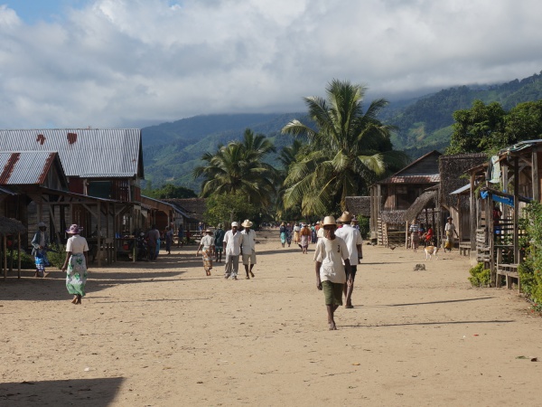
Around noon we arrived in Navana and had some lunch in one of the small restaurants. 4km later we arrived in Mahavelona, passing Anjahana along the way. Before entering Mahavelona there is a beautiful valley with rice fields and a mountainous background. In Mahavelona we stayed at Hotel Malala. After we checked in we went for a swim in the river. In the evening we had a delicious dinner in the restaurant of our hotel.
Day 2
Mahalevona - Tanambao - Fizono - Ankovana
After breakfast with tea and fried bananas at our hotel, we left the village around 6am. As the day before the trail followed the river downstream, sneaking up and down small hills and through valleys with rice fields. Today was the first time we had to cross the river by foot, which turned out to be no problem with a bit of balancing.
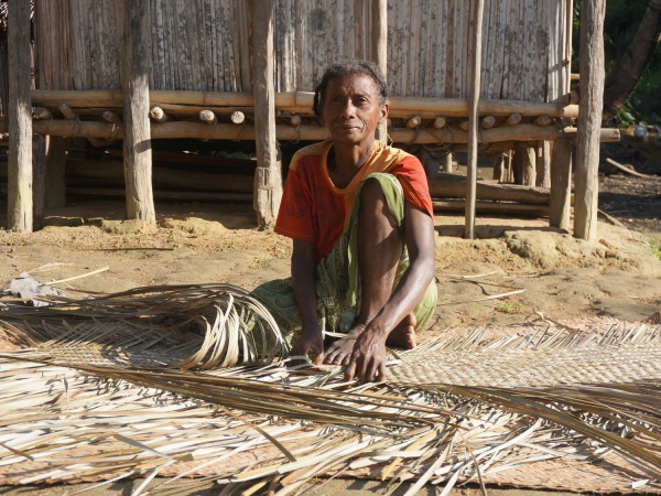
After 1 hour we reached Tanambao, another 1 hour and 20 minutes Fizono and from there about 1 hour and 45 minutes later our final destination Ankovana at noon. Ankovana is a very small village with very basic accommodation. After a chat with the woman renting out rooms at Hotel Centrale Ankovana she invited us to stay at her private house next door for 5,000 Ariary per person. We accepted her invitation and were rewarded with a huge dinner (rice, fried egg, boiled vegetables and cucumber salad). Happy and with a full stomachs we fell asleep.
Day 3
Ankovana - Ambatolaidama - Ambohimarina - Ampokafo
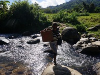
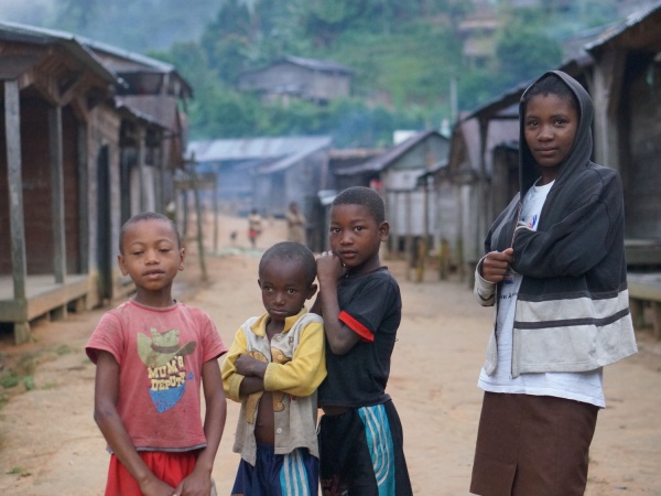
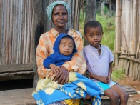
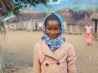
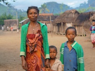
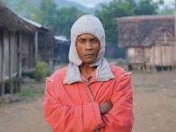
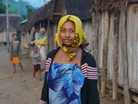
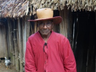
To avoid the heat of the day we started our walk as usual around 6am. The scenery is similar to the one the day before. However, the highlight is the short walk through Park Ambatolaidama. At the park entrance, the trail starts at an elevation of 375m and goes up to 542m at the exit. The maximum 90 minutes walk through the Masoala forest is steep, humid and very slippery on wet days. The forest is filled with the sound of numerous birds.
| ||
|
|
|
|
|
|
After leaving the park we reached Ampokafo at 11.45am, where we found a bed for the night at Hotel Esperante. A short stroll from the village we enjoyed a refreshing bath in the river. Thereafter we discovered the village and found a shop with a cinema behind. The owner agreed to recharge our camera batteries whilst showing a film in the evening. We just had to pay for the diesel.
Day 4
Ampokafo - Manakambahiny - Tsaratanana - Andrakadilana - Androfary - Antakotako - Ambalaharongana
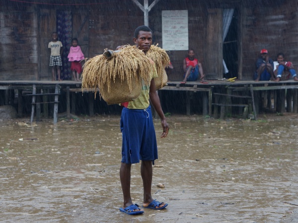
Heavy rain in the night and early morning hours delayed our departure a bit. We soon realised that the trail had turned into a mud pool, making it quite difficult to walk. Sliding backwards down a hill with the hands stretched out in the hope to hold on something, whilst trying not to completely lose the balance or searching for a shoe which got stuck in the mud were only some of the challenges we had to solve. But after even our guide once ended up on his buttocks we did not feel too much like clumsy vazaha anymore.
At around 1.30pm we arrived in Ambalaharongana where we went straight to the river to clean us and our clothes from the mud of the day. Besides a school and football field there is not much to see in the village, so we went early to bed in Hotel Fitsaharana.
Day 5
Ambalaharongana - Antsambalahy - Analampotsy - Antsahabe - Antsefapiana - Tsarafanahy - Marofinaritra - Maromandia - Antombana - Antsahandriana - Antserasera - Mahatsara - Fiangonana - .... - Antalaha
The most challenging day - not in elevation but distance, as we walked over 50km to make it to Antalaha before night. After leaving Ambalaharongana at 6am we reached Marofinaritra at almost 10am. The trail ends at Marofinaritra and the road to Antalaha starts. But "road" does not necessarily mean cars. There is the occasional 4x4 taxi or more likely taxi motorbike on the road. The scenery changes slowly from rice fields to more and more villages and fruit plantations.
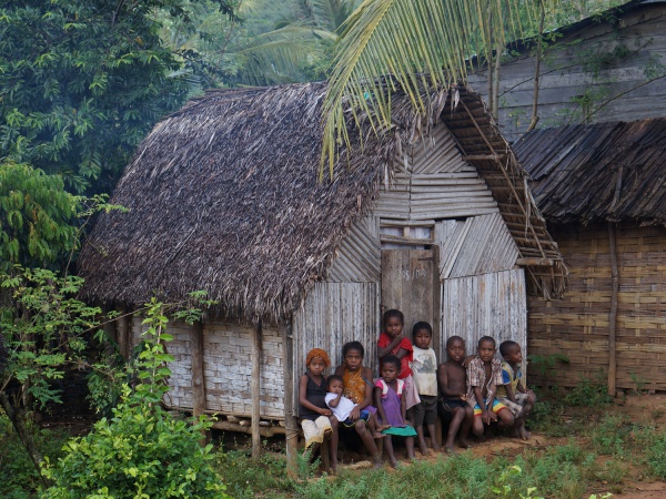
As it was Sunday, we walked the last few kilometres together with hundreds of kids who left their villages for a week of school in Antalaha. As the distances are too long to walk back and forth each day, the kids stay throughout the week in the town. After 63,086 steps we finally reached Antalaha just after sunset, exhausted but happy and very proud! It was a great feeling to have been able to answer with "YES" when being asked at the borders of the city if we came from Maroantsetra and to see the admiration in the eyes of askers!
And without a doubt - we will do the walk again!
Villages along the trek
pirogue ride to Andranofotsy
Navana (last accessible point for cars)
Mahalevona (1st night at Hotel Malala)
Ankovana (2nd night at private house of the owner of Hotel Centrale Ankovana)
Ambatolaidama (Entrance to Masoala National Park)
Ampokafo (3rd night at Hotel Esperante)
Tsaratanana (not to be mistaken with Tsaratanana in the north)
S 15°11.973' E050°04.803' - Paradise found!
Ambalaharongana (4th night at Hotel Fitsaharana)
Marofinaritra (start of road to Antalaha)
....
Open Questions
How to get to Maroantsetra?
For sure the easiest and fastest way to get to Maroantsetra is by plane.
Air Madagascar flies several times a week between Maroantsetra, Antananarivo,
Tamatave, Antalaha and Sambava. It is recommended to buy a ticket well in advance,
as the planes are usually quickly booked up.
The RN5 connects Maroantsetra with the south. It is possible to take a car from Mananara, but the road is in a very bad condition, making a drive almost impossible especially throughout the rainy season. It is definitely safer and maybe even quicker to walk from Mananara to Maroantsetra.
The third alternative is to come by the sea with an occasional cargo boat (boutres) from Tamatave.
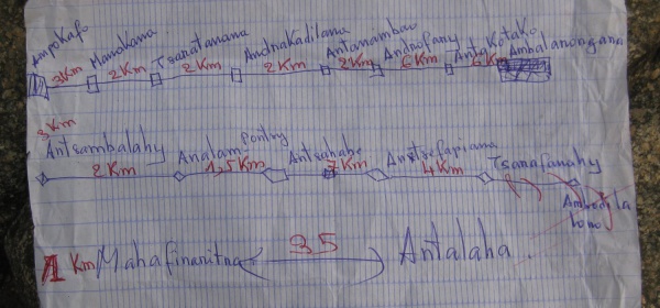
How many days does it take to trek from Maroantsetra to Antalaha?
That entirely depends on you and your physical fitness level. The average Malagasy does the trek in 2 days with an overnight stay in Ampokafo. In 2010 we did the in 4 days, now in 2014 it took us 5 days. Unless time is short, try not to rush only to find yourself back in a crowded city again! Instead, adjust to the pace of life of the farmers and villagers around you and learn to enjoy their near complete isolation from the rest of the world.
Do I need a guide?
Having done the trek already once before in March 2010 we seriously considered the necessity of a guide for our May 2014 trek. We came to the conclusion that a guide is not really a must. After the pirogue ride from Maroantsetra to the "harbour" of Andranofotsi the trail sneaks along the coastline until reaching Navana. From there one follows a river downstream for the next couple of days. Actually, it is quite hard getting lost and there are always numerous Malagasy people doing the same trek one could ask for directions.
Regarding the entrance fee for Masoala National Park - one crosses the park only for maximum 90 minutes, so we did not obtain a ticket for that short time in advance. What could happen? Sending us back to Maroantsetra to buy a ticket? We do agree to obtain a ticket and a guide if one plans to stay longer in the park or crossing the Masoala Peninsula to Cap Est!
In the end we decided to take a guide anyway. First of all to have somebody to talk to, and as our French and Malagasy is very limited it is helpful to have an interpreter. The second reason was convenience combined with a bit of selfishness in that we needed an extra person to help us to carry the weights of our cameras and laptop safely across rivers where water level may be too high.
What about wildlife?
The hike through a part of the Masoala National Park is very short, so the spotting of wildlife is very limited. The trek is rather a cultural experience. You will hike through cultivated areas, passing countless small villages. You will get an insight into the daily life of the Malagasy people. You will see them working on their fields, which are mainly rice fields, or in their small vanilla and coffee plantations.
Where do I sleep?
You have the choice of bringing a tent or sleep in one of the local accommodations. There are quite a few villages which offer rooms. Please keep in mind that the rooms are very basic, it is more of having a roof over the head. However, the best accommodation is Hotel Malala in Mahalevona, other villages with hotels offering rooms are Fizono, Ankovana, Ampokafo, Ambalaharongana and Marofinaritra. A room usually costs 5.000 Ariary a night (2014), the room for the guide is usually free (depending on the hotel). You may want to bring a sheet or a lamba to cover yourself in the night as not all hotels have proper blankets.
What about food and fresh water?
We recommend to bring some water purification tablets and an empty bottle in case the shops are out of bottled water. So far we have been lucky, throughout both of our treks Eau Vive was available in the shops of the villages we stayed in. In case of water shortage, the empty bottle can be filled with river water or fresh rainwater and cleaned with the tablets if necessary. Of course, there is also the option of boiling the water for a couple of minutes. One can also drink ranovola - rice water. Ranovola is usually served at restaurants and is simply water which is added to partly burnt rice in the kettle and boiled for a while to loosen the burnt rice. Ranovola is sterile and completely safe to drink. It can also be used for treating diarrhoea.
Regarding food, there will be no risk of starving if one does not expect a 3-course meal each evening. Throughout the hike, there are plenty of bananas in all possible sizes available, perfect as a quick stomach filler and energy push. Depending on the season, there might even be pineapples. Furthermore one can buy mofo gasy (fried sweet rice cake), banana bread, banana cake, lasopy akondro (banana soup), koba akondro (bananas, honey and rice/cornflour steamed in banana leaves) or mofo akondro (banana fritters). A change in the diet brings cassava and rice. In most of the larger villages one can find at least one restaurant. All hotels where we stayed for the night prepared delicious meals in the evening, usually of the obligatory huge portion of rice, combined with eggs, cucumber or beans. For meat-eaters, there might be even some fried chicken.
What should I bring?
- base cap
- good quality trekking sandals - We prefer wearing trekking sandals over hiking boots. With sandals it is no problem to walk through the water when crossing rivers or across muddy and very wet rice fields. Boots are just a hassle to be taken on and off.
- rain protection - The Masoala Peninsula is a rain-rich region and occasional rain showers should be expected. As special rain clothes steal space in the backpack and are annoying to be taken on and off we decided to go for umbrellas. So far we might be the only vazaha which did the trek holding umbrellas over the heads, but we can highly recommend it! The umbrellas are not only useful to stay dry when it is raining, they can be also used as protection against the strong sun or as a walking stick on slippy or steep parts of the trail. Throughout the time we did not need them we simply hanged them on the backpack.
- camera batteries - There is no electricity in the villages. However, keep your eyes open for a "cinema" as such a place has a generator and against some Ariary the owner might recharge your battery whilst showing a film.
- pocket light
- huge plastic bags - To protect the clothes and technical equipment from the sometimes very heavy rain showers we put everything in huge plastic bags and thereafter in the rucksack.
- toilet paper
- small towel - For drying after the refreshing swims in the river.
- plaster and wound spray
- sun lotion
- mosquito repellent or fumakilla (mosquito spiral) - In June 2014 we did not see a single mosquito, at other times of the year that can be different.
- small denomination Ariary notes - As the small snacks cost only a couple of hundred Ariary and changing a 10.000 Ariary note can be a problem.
- last but not least - A friendly Manahoana! (hello), Mbola tsara! or Salama! combined with a smile for all the hundreds of greeting kids and villagers!
If you have more questions about the trek don't hesitate and send us an email. We are more than happy to help you with your planning.
MissMada and ZebuKing

